UAVs for Surveying & Mapping
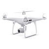
Unmanned aerial vehicles, commonly known as UAVs or drones, have revolutionized the construction industry. With rapid advances in technology and dozens of use cases, construction drones are becoming more and more common on jobsites. Drones are often used for aerial mapping and land surveys due to their ability to get a bird’s eye view of the entire area. They can quickly map complex areas for large-scale construction projects to prevent working on ill-suited terrain. Drone surveying can exponentially cut down on the time required to visualize a site's topography, saving you time and money and keeping the project both on time and within the budget.
Aerial survey drones can also fly in close to look at tiny details, making them ideal for inspections of high-up or hard-to-reach places. Roughly one-third of worker fatalities on construction sites are from falling. Don’t risk your employees’ health by making them climb scaffolding to examine every detail of a high-rise in the making. Send the drone to do it. With their high-resolution video cameras and easy-to-learn remote controls, you can get a good look at any part of the projects from the safety of the ground.
Project managers, tech managers, and superintendents are utilizing drone surveying to improve data-gathering processes, ensure project timelines, and maintain overall safety on the construction site. With their so many uses, it's not hard to see why UAVs and drones in construction are quickly becoming a common sight on any project. Superior Instrument is Connecticut's only complete sales and in-house service source for construction lasers, machine control, and surveying instruments, including UAV drones. Shop our selection of construction drones and UAVs below.