|
DJI Phantom Drone Series for Construction Surveying
The use of drones in construction and engineering continues to take off, especially in recent years. The ever-evolving technology of drones has allowed for faster, more accurate and more efficient projects. There has been a significant uptick of commercial drone usage in the construction sector, increasing well over 200% in the last few years. The industry continues to grow, and drones are a notable part of that growth, simplifying numerous steps in daily operations for projects around the world.
Among so many, one of the most obvious benefits of UAV/drone usage in the construction and engineering industry is the increased accuracy of aerial mapping and surveying. While aerial mapping is commonplace throughout the industry, drones are astonishingly accurate when mapping a project, even on short notice. Drones are up to five times faster than traditional surveying methods! They are also easily transported and deployed, and they can obviously overcome most any terrain obstacle that would otherwise cause surveying by foot to be difficult.
⦁ They reduce time on site/boots on the ground, lowering costs.
⦁ They mitigate risk and increase safety.
⦁ Drone software allows for easy capturing and replicable data sets.
⦁ They provide better project updates/management.
⦁ Drone use improves collaboration.
How Does a Drone Reduce the Cost of Surveying?
Investing conventional aerial mapping and surveying budgets into drone and mapping software allows teams to capture precise data faster than ever before, and at a much lower cost. A handmade topographic map can be very expensive (ranging anywhere from $2,000 to $15,000 based on the size of the jobsite) and take much longer to complete, and due to the limited number of shots the survey can conduct, there may be room for error.
Add in the expense of an aerial topographic survey, and you can count on the overall cost and time needed to complete the survey being significantly more, especially given the need to make flyover arrangements well in advance. There’s also the processing of vast amounts of data involved. Potential divergences can affect calculations, which ultimately leads to project delays and unplanned costs.
On the other hand, drones are not only much less expensive but also allow the survey team to better control the quality and accuracy of the aerial deliverables while decreasing project timelines. Best-in-class drone mapping technology can currently reconcile surveying sites to 1 cm of accuracy with ease.
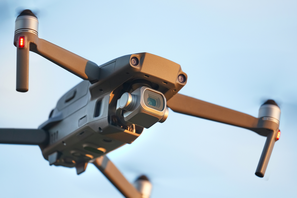
DJI Phantom drones are another step in making construction surveying with drones simpler and more efficient. Below we will take a look at a couple of the drones in the series and the additional benefits they bring to the toughest jobs on the site.
DJI Phantom 4 PRO+ V2 Drone
The DJI Phantom 4 Pro+ V2 is the most recent model in the Phantom series designed to improve upon the original Phantom 4, and the very drone that is said to have elevated DJI as the world leader in drones. We can thank its immense feats in engineering, design, and modernization for that! Advancements made on this model include improved ESCs (electronic speed controllers), low-noise propellers, and the OcuSync 2.0 HD transmission system that ensures stable connectivity and reliability while surveying.
The main differences and features:
⦁ The OcuSync 2.0 transmission system allows the drone to connect to DJI goggles wirelessly.
⦁ It has a longer video transmission distance.
⦁ It provides obstacle sensing in five directions.
⦁ Phantom 4 PRO+ V2 has three flight modes and ⦁ 12 intelligent flight modes.
⦁ The top camera includes an excellent auto mode and a terrific range of manual settings.
⦁ It features an expanded flight autonomy, with five directions of obstacle sensing and four directions of collision avoidance.
⦁ The remote controller has a built-in 5.5”, 1080p screen containing the DJI Go 4 app, so you can see what you are doing even in bright sunlight.
The new and improved Phantom 4 PRO+ V2 has a wide array of intelligent features that make flying that much easier, safer, and more efficient.
DJI Phantom 4 RTK Drone
The DJI Phantom 4 RTK is considered to be the best entry-level survey drone. It’s a drone that is mindfully designed for aerial surveying and 3D mapping, and built specifically with surveyors in mind. This custom-built quadcopter was designed from the ground up with the most compact and accurate low-altitude mapping solution while requiring fewer ground control points. This results in:
⦁ 1cm+1ppm RTK horizontal positioning accuracy
⦁ 1.5cm+1ppm RTK vertical positioning accuracy
⦁ 5cm absolute horizontal accuracy of photogrammetric models
A new RTK module is incorporated directly into the Phantom 4 RTK, providing real-time, centimeter-level positioning data for improved absolute accuracy on image metadata. Satellite observation data is also stored for post-processed kinematics (PPK). You can further support your Phantom 4 RTK missions with the D-RTK 2 Mobile Station, which provides real-time differential data to the drone and forms an accurate surveying solution.
In addition, the phantom RTK incorporates a 1″ CMOS 20 megapixel camera to give you sharp and comprehensive images. Due to the high resolution, the Phantom 4 RTK can achieve a ground sample distance (GSD) of 2.74 cm at 100 meters flight altitude and has a battery life of up to 30 minutes. This allows for mapping of large areas in a single flight. If the area is too large to map on a single battery, the system will automatically resume the mission at the same point after the battery has been replaced.
The Future of Drones in Construction
DJI has done an unparalleled job of collecting information from its early consumer-level drones and combining it with the standards of the survey and mapping industry, resulting in mighty yet uncomplicated drones capable of transforming everyday operations. They are easy-to-use devices that combine advanced technology with dynamic design. In addition to dynamic drone models, the company offers many accessories to further support them, and to help make your projects and operations even more efficient and accurate.
With the growing use of drones in construction and engineering, the competition inevitably becomes tremendous. DJI is top-of-the-line competition, bringing new perspectives to its work and combining and transforming advanced technology with powerful designs.
|